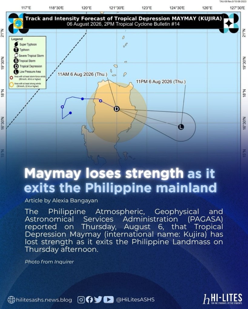
Photo from Inquirer
by Alexia Bangayan
The Philippine Atmospheric, Geophysical and Astronomical Services Administration (PAGASA) reported on Thursday, August 6, that Tropical Depression Maymay (international name: Kujira) has lost strength as it exits the Philippine Landmass on Thursday afternoon.
According to PAGASA’s 5 p.m. weather bulletin, the center of Maymay was located near Gamu, Isabela, carrying maximum sustained winds of 45 kilometers per hour (kph) and gusts of up to 60 kph while moving east-southeast at 35 kph.
The storm had weakened from its earlier strength of 55 kph sustained winds and gusts reaching 90 kph.
However, Tropical Cyclone Wind Signal (TCWS) No. 1 remains in effect over the following areas:
- Southern portion of Mainland Cagayan (Tuao, Piat, Enrile, Alcala, Amulung, Baggao, Solana, Tuguegarao City, Gattaran, Peñablanca, Iguig)
- Isabela
- Quirino
- Northeastern portion of Nueva Vizcaya (Dupax del Norte, Kasibu, Quezon, Bagabag, Diadi, Bayombong, Ambaguio, Villaverde, Bambang, Solano, Alfonso Castañeda, Dupax del Sur)
- Northern and Central portions of Aurora (Dilasag, Casiguran, Dinalungan, Dipaculao)
- Eastern portion of Kalinga (City of Tabuk, Pinukpuk, Tanudan, Lubuagan, Rizal)
- Eastern portion of Mountain Province (Paracelis, Natonin, Barlig)
- Eastern portion of Ifugao (Lagawe, Aguinaldo, Asipulo, Hingyon, Kiangan, Lamut, Alfonso Lista, Mayoyao, Banaue)
PAGASA said the remnants of Maymay may merge with Typhoon Dolphin, which remains outside the Philippine Area of Responsibility (PAR) but could enhance the southwest monsoon and bring rains to parts of the country.
Meanwhile, several Local Government Units (LGUs) announced the suspension of classes due to the weather conditions brought by the tropical depression.
 HiLites ASHS