
From DOST – PAGASA
By Noriko Yamamoto
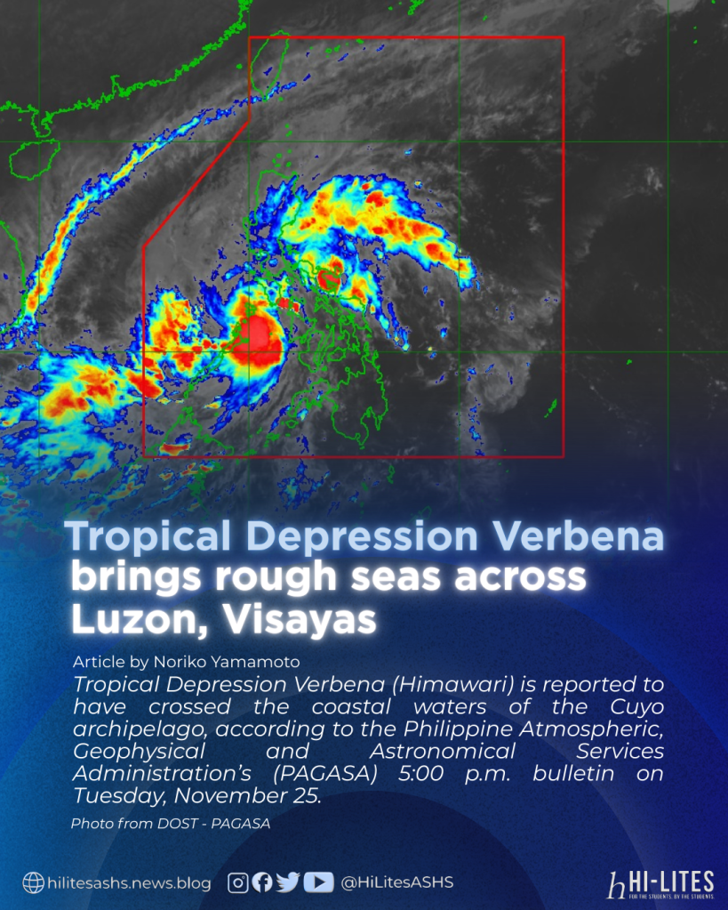
Tropical Depression Verbena (Himawari) is reported to have crossed the coastal waters of the Cuyo archipelago, according to the Philippine Atmospheric, Geophysical and Astronomical Services Administration’s (PAGASA) 5:00 p.m. bulletin on Tuesday, November 25.
PAGASA has maintained Tropical Cyclone Wind Signal No.1 over several areas expected to be affected by the weather disturbance, emphasizing that areas under Signal No. 1 may experience strong winds, with slightly stronger gusts in coastal and upland locations.
The storm’s center was last located 35 kilometers west of Cuyo, Palawan, at 10.8 °N, 120.7 °E, based on data from the Iloilo Doppler Weather Radar.
Verbena is currently moving westward at 25 kilometers per hour, with winds of 39 to 61 kph and intermittent rains expected within the next 36 hours.
Several areas such as Occidental Mindoro, Oriental Mindoro, the southern portion of Romblon, and the northern and central portions of Palawan — including the Calamian, Cuyo, and Cagayancillo Islands — remain under Signal No. 1.
Signal No. 1 was also raised in the Visayas — particularly in Antique and the northwestern portion of Aklan.
Moreover, minimal damage is expected in low-risk structures, while high-risk structures may sustain light to moderate damage — with agricultural crops such as rice, being the most affected by the cyclone.
Sea conditions over the seaboards of Batanes, Babuyan Islands, Ilocos Norte, and Ilocos Sur are predicted to reach up to six meters, while waves of up to five meters are expected over the seaboards of the Kalayaan Islands and the northern coast of mainland Cagayan.
Meanwhile, the remaining seaboards of the Ilocos Region and mainland Cagayan may see waves reaching 4.5 meters.
PAGASA has also warned the public that sea travel remains risky for all vessels and advised mariners to stay in port or seek shelter.
With this, rough seas of up to four meters are also expected over the seaboards of Isabela, Aurora, northern mainland Quezon, northern Palawan, the Calamian Islands, and Polillo Islands.
On the other hand, waves reaching 3.5 meters are likely to arise in Caramines Norte, Antique, the Cuyo Islands, Zambales, Occidental Mindoro, Oriental Mindoro, Catanduanes, and certain parts of Palawan.
Meanwhile, up to three-meter waves are predicted in Bataan, Albay, Sorsogon, Eastern Samar, Dinagat Islands, Northern Samar, and the Siargao-Bucas Grande Islands.
Additionally, moderate to rough seas of up to 2.5 meters may affect Marinduque, Romblon, Aklan, Surigao del Sur, Davao Occidental, Oriental Mindoro, Camarines Sur, Davao Oriental, Masbate, Negros Occidental, Palawan, Iloilo, Guimaras, Quezon, and Catanduanes, while waves of up to two meters are forecast along the Batangas coastline and the remaining seaboards of Occidental and Oriental Mindoro.
Small sea vessels, including motorbancas, are strongly advised not to venture out due to hazardous conditions brought about by the weather, and mariners operating small vessels are urged to take precautionary measures and avoid sea travel when possible.
As of present time, PAGASA has advised the public to inspect homes for necessary repairs, clear drainage systems, harvest crops ready for yield, and monitor weather bulletins every six hours along with hourly updates.
